 geocatalogue.geoportail.lu
unemployment, youth
Type of resources
Available actions
Topics
Keywords
Contact for the resource
Provided by
Groups
Years
Representation types
Update frequencies
status
Scale
-
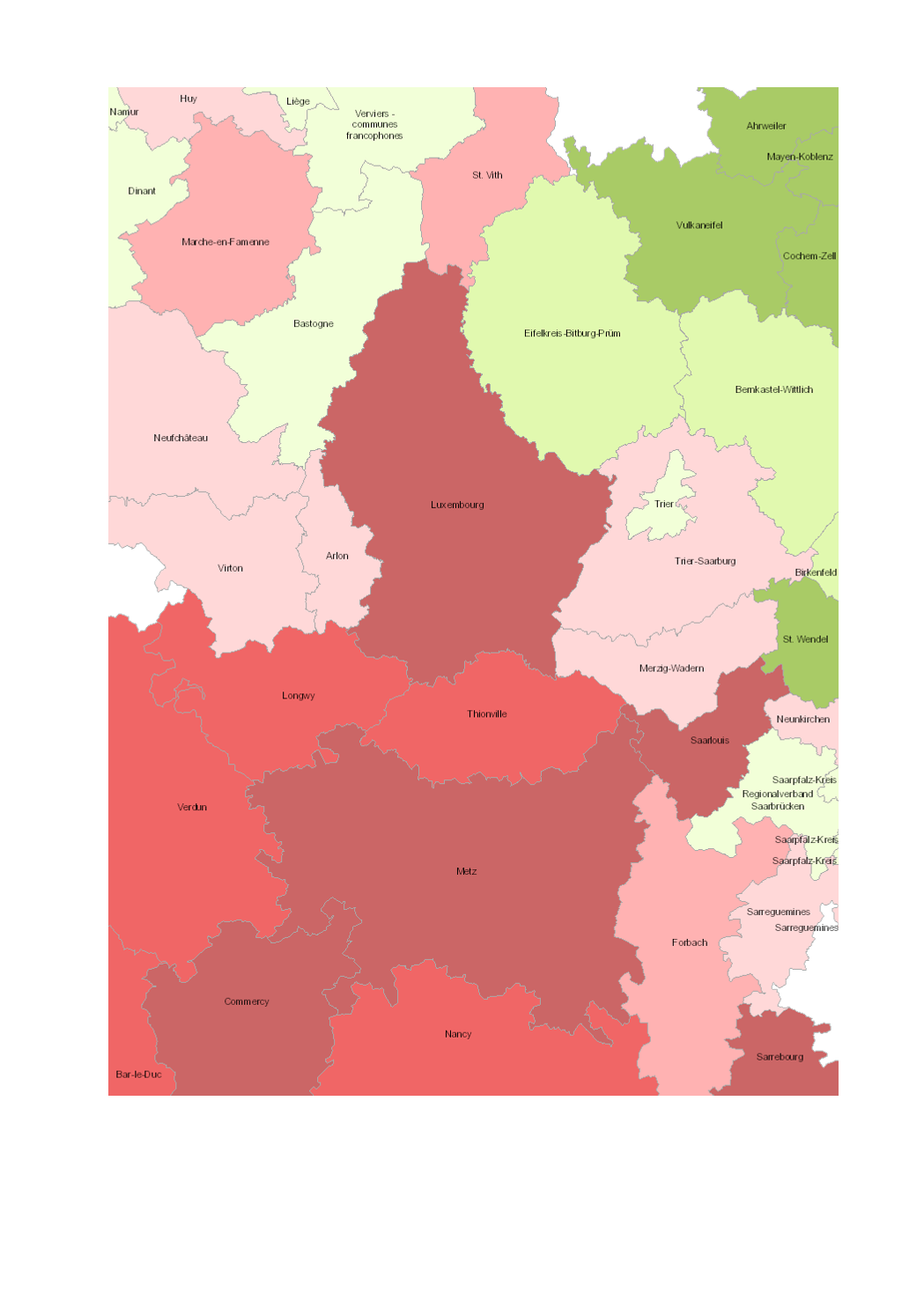
Change in total number of young unemployed (15-24 years) 2008-2012 - Territorial entities: arrondissements (Wallonie), zones d'emploi (Lorraine), Grand Duchy (Luxembourg), Kreise (Saarland, Rheinland-Pfalz) - Employment data sources: ADG, Bundesagentur für Arbeit, Eurostat, Le Forem, Lorraine Parcours Métiers, Pôle d'emploi, Statec. Berechnungen: OIE/IBA 2014 - Geodata sources: EuroGeographics EuroRegionalMap v3.0 - 2010. Harmonization: SIG-GR / GIS-GR 2014
-
Change in total number of young unemployed (15-24 years) 2008-2015 - Territorial entities: arrondissements (Wallonie), zones d'emploi (Lorraine), Grand Duchy (Luxembourg), Kreise (Saarland, Rheinland-Pfalz) - Employment data sources: ADG, Bundesagentur für Arbeit, Eurostat, Le Forem, Lorraine Parcours Métiers, Pôle d'emploi - Dares, Statec. Berechnungen: OIE/IBA 2017 - Geodata sources: EuroGeographics EuroRegionalMap v9.1 - 2016. Harmonization: SIG-GR / GIS-GR 2017
-

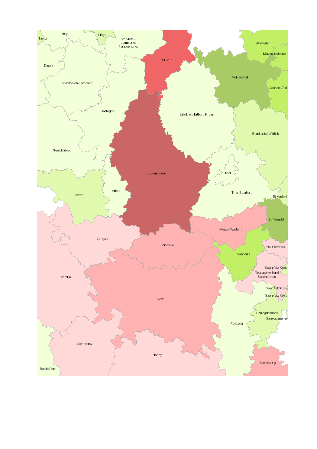
- Change in total number of young unemployed (15-24 years) 2010-2017 - Territorial entities: arrondissements (Wallonie), zones d'emploi (Lorraine), Grand Duchy (Luxembourg), Kreise (Saarland, Rheinland-Pfalz) - Employment data sources: ADEM; ADG; Bundesagentur für Arbeit; Eurostat; Le Forem; Pôle d'emploi - Dares. Calculations: OIE/IBA 2018 - Geodata sources: ACT Luxembourg 2017, IGN France 2017, GeoBasis-DE / BKG 2017, NGI-Belgium 2017. Harmonization: SIG-GR / GIS-GR 2018